
📊 Full opportunity report: Can A Quest App Help Improve OpenStreetMap? Meet StreetComplete on IdeaNavigator AI — validation score, market gap, and execution plan.

Get smart everyday buys delivered free with Prime
- Fast, free delivery on millions of items
- Prime Video, Amazon Music and more included
- Member-only deals all year
TL;DR
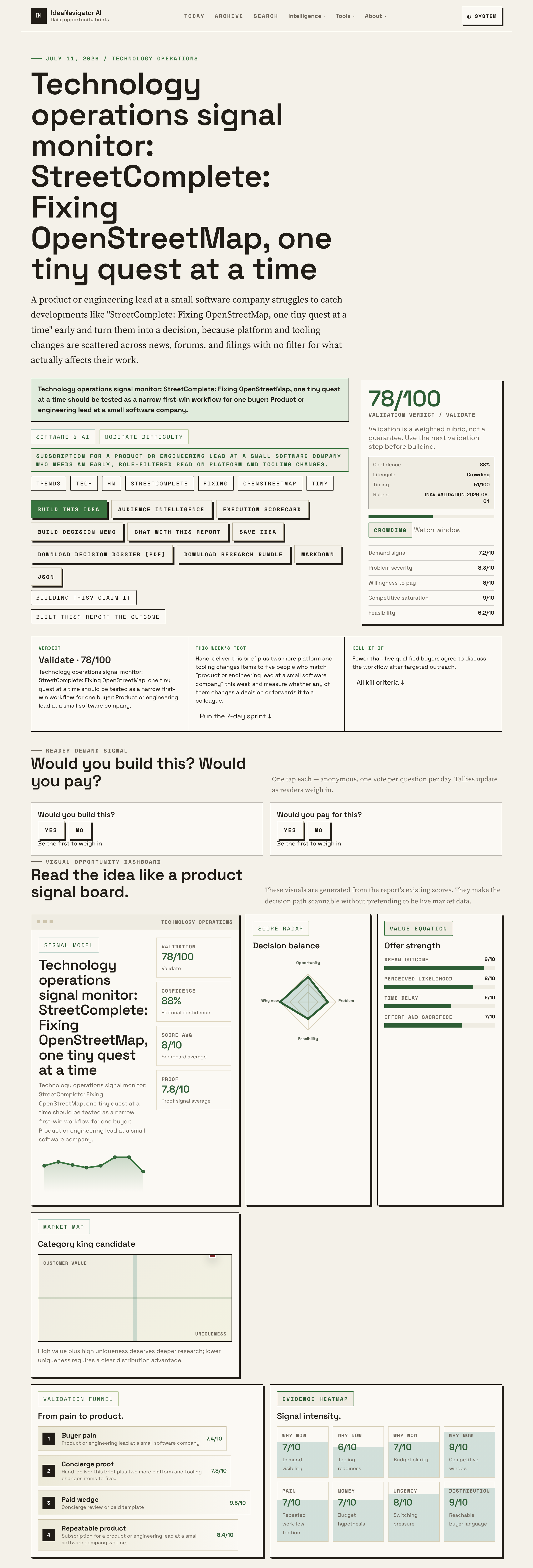
StreetComplete, an open-source Android app, gamifies contributing to OpenStreetMap by asking users targeted ‘quest’ questions about nearby map features. Attention renewed after a Hacker News discussion scored an estimated 88/100 signal. The app lowers the barrier to mapping contributions but covers only simple, answerable data gaps.
StreetComplete, a free open-source Android app that improves OpenStreetMap by asking users to answer simple, location-based questions, is drawing renewed attention after a Hacker News discussion — scored at an estimated 88/100 signal by IdeaNavigator AI — highlighted the app’s role in keeping the world’s largest crowdsourced map accurate. Rather than requiring users to learn OpenStreetMap’s full editing tools, the app presents small, answerable “quests” about nearby streets and points of interest, making map contribution accessible to casual users.
StreetComplete works by scanning OpenStreetMap data around a user’s location and identifying missing or outdated attributes — for example, whether a road is lit, what surface a path has, or whether a shop accepts card payments. The app then displays these gaps as map markers. When a user taps a marker, they see a simple multiple-choice or short-answer question rather than OpenStreetMap’s full editing interface. Each answered quest uploads a targeted data change directly to OpenStreetMap, attributing the contribution to the user’s account.
The app is built around the principle that small, structured contributions from many users can collectively close large data gaps. Because every quest is constrained to a predefined question with predefined answer formats, the app avoids many of the errors that free-form editing by beginners can introduce. According to the framing surfaced in the Hacker News discussion — titled “StreetComplete: Fixing OpenStreetMap, one tiny quest at a time” — this quest model is what makes the tool effective for non-experts who want to contribute without studying mapping conventions.
According to IdeaNavigator AI, which flagged the discussion as a high-signal item relevant to technology operations and platform-tooling watchers, the story’s renewed visibility reflects how quickly decentralized platform changes now spread through community feeds rather than official announcements. The app itself is developed as an open-source project, with its code and quest definitions publicly reviewable.
Why Quest-Based Mapping Matters for OpenStreetMap
OpenStreetMap underpins mapping features in countless applications, from routing services to humanitarian response tools, but its usefulness depends on the completeness and freshness of its attribute data. Traditional editing requires learning dedicated editors and tagging conventions — a barrier that keeps most casual users from contributing. StreetComplete’s significance lies in removing that barrier: a user walking down a street can answer a handful of questions in minutes and meaningfully improve local map quality.
The quest model also demonstrates a broader pattern relevant to crowdsourced data projects: decomposing a complex contribution task into tiny, validated micro-tasks dramatically widens the contributor base. For product and engineering leads watching platform-tooling trends, as IdeaNavigator AI’s signal monitoring suggests, StreetComplete is a working example of structured gamification producing real, attributable data improvements rather than engagement for its own sake.
How StreetComplete Reached Hacker News Attention
StreetComplete has existed as an open-source project for several years, maintained by volunteer contributors, and has previously been discussed in OpenStreetMap community forums and on technology aggregators. Its recent visibility stems from a Hacker News thread titled “StreetComplete: Fixing OpenStreetMap, one tiny quest at a time”, which IdeaNavigator AI scored at 88/100 as a signal worth monitoring for technology-operations professionals.
OpenStreetMap itself, launched in 2004, operates as a collaborative project where volunteers edit a shared global map database. Editors range from professional-grade desktop tools to simplified mobile apps, with StreetComplete occupying the simplest end of that spectrum — it deliberately does not allow creating new map objects, only annotating existing ones, which keeps the scope of user contributions narrow and verifiable.
What the Signal Score Does Not Tell You
Several things remain unclear from the available information. The 88/100 signal score is a proprietary metric from IdeaNavigator AI; its methodology and what specifically drove the score are not publicly detailed, and a high score does not equate to a new product release or measurable change in the app itself. It is not clear whether the Hacker News discussion reflected a recent app update, a milestone, or simply renewed community interest.
Additionally, the actual volume of map contributions attributable to StreetComplete — and its share of total OpenStreetMap edits — is not stated in the available material, so the app’s aggregate impact on map quality cannot be quantified here. Availability of specific quest types and current release details would need to be confirmed from the project’s own documentation.
Where StreetComplete and Signal Monitoring Go From Here
For StreetComplete, development continues as an open-source project, with new quest types typically proposed and refined through its community channels. Users interested in contributing can install the app on Android and begin answering quests tied to their OpenStreetMap accounts.
For the monitoring angle, IdeaNavigator AI proposes validating its role-filtered briefs by delivering them to a small set of technology decision-makers and measuring whether the information changes a decision or gets forwarded to a colleague. Whether that validation succeeds — and whether community-surfaced signals like this one reliably translate into actionable intelligence for engineering leads — remains to be tested.
Source: IdeaNavigator AI
Key Questions
What is StreetComplete?
StreetComplete is a free, open-source Android app that lets users improve OpenStreetMap by answering simple, location-based questions called quests — such as a road’s surface type or whether a shop accepts cards — instead of using full map editors.
Do I need mapping experience to use StreetComplete?
No. The app is designed for casual users: each quest presents a structured question with predefined answers, so no knowledge of OpenStreetMap tagging conventions is required. Users need an OpenStreetMap account for their contributions to be attributed.
Why is StreetComplete getting attention now?
A Hacker News discussion titled “StreetComplete: Fixing OpenStreetMap, one tiny quest at a time” resurfaced the app, and IdeaNavigator AI scored the item at 88/100 as a high-signal platform-tooling development worth monitoring.
Can StreetComplete add new places to the map?
No. The app deliberately limits users to annotating existing map objects; creating new features requires traditional OpenStreetMap editors. This constraint keeps contributions narrow and easier to verify.
Is StreetComplete available on iOS?
The available material describes it as an Android app. Its availability on other platforms is not stated and would need to be confirmed through the project’s official channels.
Source: IdeaNavigator AI
Fall Picks
fall essentials
As an affiliate, we earn on qualifying purchases.